 vesseltracker.com
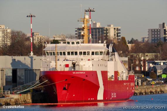
 Sir John Franklin
Current Status
Where is the vessel?
Sir John Franklin is currently in 32 nm S of Nootka, based on AIS data received about 1h ago.
Latest AIS update:
Current position: 49.07253° N, 126.50410° W (32 nm S of Nootka)
Average speed (last 7 days): Loading…
Average speed (last 30 days): Loading…
Vessel profile: Sir John Franklin is a Fishing Vessel with dimensions 64m x 16m.
This page combines live AIS, route history, probable destination signals, nearby traffic, and port activity for practical vessel monitoring.
The current position of vessel Sir John Franklin is 49.07253 lat / -126.50410 lng. Updated: 2026-05-02 14:22:20 UTCNearest reference points:
- 21 nm NW of Tatoosh Island
- Near PORT HARDY
- Near Powell River
Currently sailing under the flag of Canada ![]()
Details:
Live Vessel Sir John Franklin Analytics (details, animations, etc.)
Recent AIS points (UTC):
2026-05-02 10:50:11 UTC · 49.21483, -126.49170 · SOG 6.4 kn · COG 153°2026-05-02 12:11:30 UTC · 49.09075, -126.38252 · SOG 6.1 kn · COG 153°
2026-05-02 13:52:11 UTC · 49.06237, -126.46398 · SOG 3.9 kn · COG 283°
2026-05-02 14:22:20 UTC · 49.07253, -126.50410 · SOG 2.3 kn · COG 310°