 vesseltracker.com
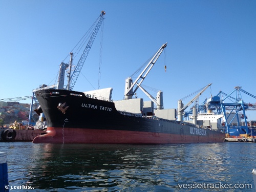
 Ultra Tatio
Current Status
Where is the vessel?
Ultra Tatio is currently in Near SLUISKIL, based on AIS data received less than 1h ago.
Latest AIS update:
Current position: 51.26086° N, 3.83914° E (Near SLUISKIL)
Average speed (last 7 days): Loading…
Average speed (last 30 days): Loading…
Vessel profile: Ultra Tatio is a Bulk Carrier with dimensions 180m x 30m.
This page combines live AIS, route history, probable destination signals, nearby traffic, and port activity for practical vessel monitoring.
The current position of vessel Ultra Tatio is 51.26086 lat / 3.83914 lng. Updated: 2026-05-15 07:36:33 UTCNearest reference points:
- Near SLUISKIL
- Near Terneuzen
- Near Rieme
Currently sailing under the flag of Marshall Is ![]()
Details:
Live Vessel Ultra Tatio Analytics (details, animations, etc.)
Recent AIS points (UTC):
2026-05-15 04:39:32 UTC · 51.26085, 3.83913 · SOG 0.1 kn · COG 166°2026-05-15 06:18:33 UTC · 51.26084, 3.83914 · SOG 0 kn · COG 166°
2026-05-15 07:09:33 UTC · 51.26086, 3.83914 · SOG 0.1 kn · COG 166°
2026-05-15 07:36:33 UTC · 51.26086, 3.83914 · SOG 0 kn · COG 166°