 vesseltracker.com
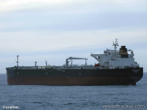
 AQUASURAZO
Current Status
Where is the vessel?
AQUASURAZO is currently in 45 nm N of Piñas, based on AIS data received less than 1h ago.
Latest AIS update:
Current position: 4.42390° N, 79.66454° W (45 nm N of Piñas)
Average speed (last 7 days): Loading…
Average speed (last 30 days): Loading…
Vessel profile: AQUASURAZO is a Tanker with dimensions m x m.
This page combines live AIS, route history, probable destination signals, nearby traffic, and port activity for practical vessel monitoring.
The current position of vessel AQUASURAZO is 4.42390 lat / -79.66454 lng. Updated: 2026-05-15 17:44:24 UTCNearest reference points:
- 33 nm W of Buenaventura
- Near Buenaventura
Currently sailing under the flag of Portugal ![]()
Details:
Live Vessel AQUASURAZO Analytics (details, animations, etc.)
Recent AIS points (UTC):
2026-05-15 13:45:07 UTC · 3.63074, -79.67609 · SOG 12.1 kn · COG 0°2026-05-15 16:01:58 UTC · 4.08399, -79.66840 · SOG 11.5 kn · COG 358°
2026-05-15 16:01:58 UTC · 4.08399, -79.66840 · SOG 11.5 kn · COG 358°
2026-05-15 17:44:24 UTC · 4.42390, -79.66454 · SOG 12 kn · COG 356°