 vesseltracker.com
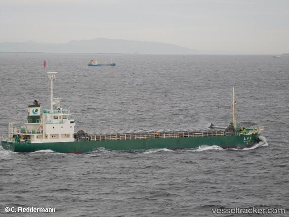
 Ryoko Maru
Current Status
Where is the vessel?
Ryoko Maru is currently in Near Kamisu, Ibaraki, based on AIS data received about 6h ago.
Latest AIS update:
Current position: 35.90067° N, 140.67816° E (Near Kamisu, Ibaraki)
Average speed (last 7 days): Loading…
Average speed (last 30 days): Loading…
Vessel profile: Ryoko Maru is a General Cargo Ship with dimensions 74m x 13m.
This page combines live AIS, route history, probable destination signals, nearby traffic, and port activity for practical vessel monitoring.
The current position of vessel Ryoko Maru is 35.90067 lat / 140.67816 lng. Updated: 2026-05-14 10:00:44 UTCNearest reference points:
- Near KASHIMA
- Near Mito
- 12 nm E of CHOSHI
Currently sailing under the flag of Japan ![]()
Details:
Live Vessel Ryoko Maru Analytics (details, animations, etc.)
Recent AIS points (UTC):
2026-05-14 10:00:44 UTC · 35.90067, 140.67816 · SOG 1.4 kn · COG 129°2026-05-14 10:00:44 UTC · 35.90067, 140.67816 · SOG 1.4 kn · COG 129°
2026-05-14 10:00:44 UTC · 35.90067, 140.67816 · SOG 1.4 kn · COG 129°
2026-05-14 10:00:44 UTC · 35.90067, 140.67816 · SOG 1.4 kn · COG 129°