 vesseltracker.com
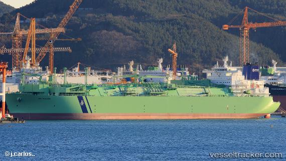
Bw Magna
Current StatusWhere is the vessel?
Bw Magna is currently in Near Açu Pt/São João da Barra, based on AIS data received less than 1h ago.
Latest AIS update:
Current position: 21.83489° S, 40.99375° W (Near Açu Pt/São João da Barra)
Average speed (last 7 days): Loading…
Average speed (last 30 days): Loading…
Vessel profile: Bw Magna is a Fsru Tanker with dimensions 46m x 295m.
This page combines live AIS, route history, probable destination signals, nearby traffic, and port activity for practical vessel monitoring.
The current position of vessel Bw Magna is -21.83489 lat / -40.99375 lng. Updated: 2026-05-14 16:27:21 UTCNearest reference points:
- Near PORTO DO ACU
- 24 nm SE of Carapebus
- Near Fluminense FPSO
Details:
Live Vessel Bw Magna Analytics (details, animations, etc.)
Recent AIS points (UTC):
2026-05-14 13:55:04 UTC · -21.83333, -40.99333 · SOG 0 kn · COG -1°2026-05-14 13:57:19 UTC · -21.83488, -40.99370 · SOG 0 kn · COG 72°
2026-05-14 16:27:21 UTC · -21.83489, -40.99375 · SOG 0 kn · COG 72°
2026-05-14 16:27:21 UTC · -21.83489, -40.99375 · SOG 0 kn · COG 72°