 vesseltracker.com
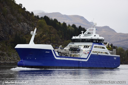
 Ro West
Current Status
Where is the vessel?
Ro West is currently in Near SVELGEN, based on AIS data received less than 1h ago.
Latest AIS update:
Current position: 61.82050° N, 5.24780° E (Near SVELGEN)
Average speed (last 7 days): Loading…
Average speed (last 30 days): Loading…
Vessel profile: Ro West is a Fish Carrier with dimensions 82m x 16m.
This page combines live AIS, route history, probable destination signals, nearby traffic, and port activity for practical vessel monitoring.
The current position of vessel Ro West is 61.82050 lat / 5.24780 lng. Updated: 2026-04-28 06:09:23 UTCNearest reference points:
- Near MALOY
- Near RAUDEBERG
- Near Eikefjord
Currently sailing under the flag of Norway ![]()
Details:
Live Vessel Ro West Analytics (details, animations, etc.)
Recent AIS points (UTC):
2026-04-28 02:30:03 UTC · 61.82046, 5.24778 · SOG 0 kn · COG 299°2026-04-28 03:59:03 UTC · 61.82051, 5.24775 · SOG 0 kn · COG 306°
2026-04-28 04:49:41 UTC · 61.82054, 5.24778 · SOG 0 kn · COG 304°
2026-04-28 06:09:23 UTC · 61.82050, 5.24780 · SOG 0 kn · COG 305°