 vesseltracker.com
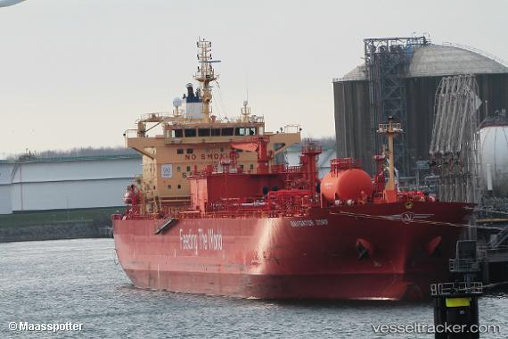
 Navigator Jorf
Current Status
Where is the vessel?
Navigator Jorf is currently in Near Texas City, based on AIS data received about 1h ago.
Latest AIS update:
Current position: 29.36047° N, 94.91296° W (Near Texas City)
Average speed (last 7 days): Loading…
Average speed (last 30 days): Loading…
Vessel profile: Navigator Jorf is a Lpg Tanker with dimensions 180m x 28m.
This page combines live AIS, route history, probable destination signals, nearby traffic, and port activity for practical vessel monitoring.
The current position of vessel Navigator Jorf is 29.36047 lat / -94.91296 lng. Updated: 2026-04-27 04:40:56 UTCNearest reference points:
- Near Texas City
- Near Port Bolivar
- Near Clear Lake Shores
Currently sailing under the flag of Liberia ![]()
Details:
Live Vessel Navigator Jorf Analytics (details, animations, etc.)
Recent AIS points (UTC):
2026-04-27 01:01:58 UTC · 29.36047, -94.91299 · SOG 0 kn · COG 0°2026-04-27 01:59:07 UTC · 29.36049, -94.91298 · SOG 0 kn · COG 0°
2026-04-27 04:19:57 UTC · 29.36047, -94.91299 · SOG 0 kn · COG 0°
2026-04-27 04:40:56 UTC · 29.36047, -94.91296 · SOG 0 kn · COG 0°