 vesseltracker.com
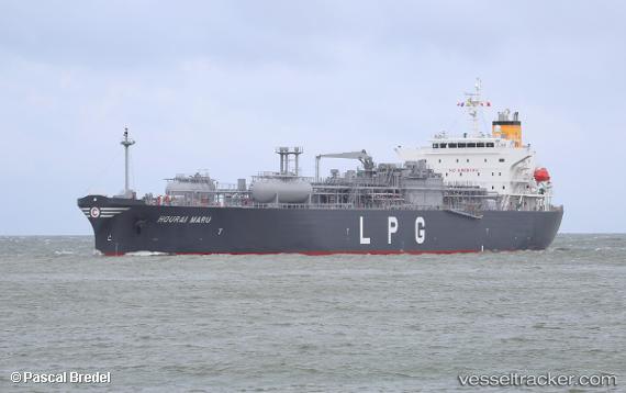
Hourai Maru
Current StatusWhere is the vessel?
Hourai Maru is currently in 10 nm N of Pierowall, Westray, based on AIS data received less than 1h ago.
Latest AIS update:
Current position: 59.48131° N, 3.10358° W (10 nm N of Pierowall, Westray)
Average speed (last 7 days): Loading…
Average speed (last 30 days): Loading…
Vessel profile: Hourai Maru is a Lpg Tanker with dimensions 30m x 183m.
This page combines live AIS, route history, probable destination signals, nearby traffic, and port activity for practical vessel monitoring.
The current position of vessel Hourai Maru is 59.48131 lat / -3.10358 lng. Updated: 2026-05-15 15:58:46 UTCNearest reference points:
- Near Tingwall
- Near STROMNESS
- Near Staxigoe
Details:
Live Vessel Hourai Maru Analytics (details, animations, etc.)
Recent AIS points (UTC):
2026-05-15 11:47:29 UTC · 59.27028, -4.59812 · SOG 10 kn · COG 58°2026-05-15 13:05:39 UTC · 59.32463, -4.12831 · SOG 11.6 kn · COG 74°
2026-05-15 13:49:56 UTC · 59.34729, -3.85169 · SOG 11.2 kn · COG 73°
2026-05-15 15:58:46 UTC · 59.48131, -3.10358 · SOG 12.8 kn · COG 74°