 vesseltracker.com
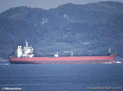
Atlantic Harmony
Current StatusWhere is the vessel?
Atlantic Harmony is currently in 38 nm E of Craigellachie, based on AIS data received less than 1h ago.
Latest AIS update:
Current position: 57.67500° N, 4.29333° E (38 nm E of Craigellachie)
Average speed (last 7 days): Loading…
Average speed (last 30 days): Loading…
Vessel profile: Atlantic Harmony is a Chemical Oil Products Tanker with dimensions 32m x 183m.
This page combines live AIS, route history, probable destination signals, nearby traffic, and port activity for practical vessel monitoring.
The current position of vessel Atlantic Harmony is 57.67500 lat / 4.29333 lng. Updated: 2026-05-13 21:52:43 UTCNearest reference points:
- Near Egersund
- Near Lura
- Near HUSOYA
Details:
Live Vessel Atlantic Harmony Analytics (details, animations, etc.)
Recent AIS points (UTC):
2026-05-13 17:25:43 UTC · 56.78333, 4.37500 · SOG 12 kn · COG -1°2026-05-13 19:40:45 UTC · 57.24333, 4.33833 · SOG 12 kn · COG -1°
2026-05-13 19:49:41 UTC · 57.27333, 4.33667 · SOG 11 kn · COG -1°
2026-05-13 21:52:43 UTC · 57.67500, 4.29333 · SOG 11 kn · COG -1°