 vesseltracker.com
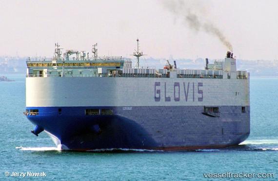
 Glovis Sunlight
Current Status
Where is the vessel?
Glovis Sunlight is currently in Near Madras, based on AIS data received about 17d ago.
Latest AIS update:
Current position: 13.09580° N, 80.29543° E (Near Madras)
Average speed (last 7 days): Loading…
Average speed (last 30 days): Loading…
Vessel profile: Glovis Sunlight is a Vehicles Carrier with dimensions 230m x 32m.
This page combines live AIS, route history, probable destination signals, nearby traffic, and port activity for practical vessel monitoring.
The current position of vessel Glovis Sunlight is 13.09580 lat / 80.29543 lng. Updated: 2026-04-15 07:24:01 UTCNearest reference points:
- Near Chennai (ex Madras)
- Near Madras
- 17 nm NE of Nandiambakkam
Currently sailing under the flag of Marshall Is ![]()
Details:
Live Vessel Glovis Sunlight Analytics (details, animations, etc.)
Recent AIS points (UTC):
2026-04-15 07:24:01 UTC · 13.09580, 80.29543 · SOG 0 kn · COG -1°