 vesseltracker.com
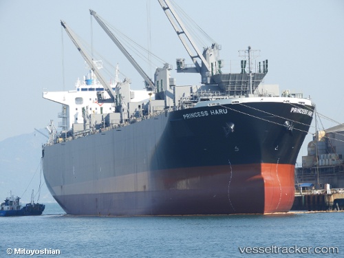
Princess Haru
Current StatusWhere is the vessel?
Princess Haru is currently in 115 nm S of Primorsky Krai, based on AIS data received about 1h ago.
Latest AIS update:
Current position: 43.43619° N, 135.85645° W (115 nm S of Primorsky Krai)
Average speed (last 7 days): Loading…
Average speed (last 30 days): Loading…
Vessel profile: Princess Haru is a Wood Chips Carrier with dimensions 32m x 199m.
This page combines live AIS, route history, probable destination signals, nearby traffic, and port activity for practical vessel monitoring.
The current position of vessel Princess Haru is 43.43619 lat / -135.85645 lng. Updated: 2026-05-16 02:09:55 UTCDetails:
Live Vessel Princess Haru Analytics (details, animations, etc.)
Recent AIS points (UTC):
2026-05-15 22:34:15 UTC · 43.47185, -135.12164 · SOG 8.3 kn · COG 270°2026-05-15 23:30:25 UTC · 43.46035, -135.30585 · SOG 9.1 kn · COG 270°
2026-05-16 01:17:45 UTC · 43.44223, -135.67085 · SOG 9.5 kn · COG 272°
2026-05-16 02:09:55 UTC · 43.43619, -135.85645 · SOG 9.1 kn · COG 269°