 vesseltracker.com
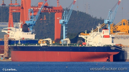
 T.semahat
Current Status
Where is the vessel?
T.semahat is currently in 24 nm S of Mirabel, based on AIS data received about 1d ago.
Latest AIS update:
Current position: 39.46512° N, 6.35955° E (24 nm S of Mirabel)
Average speed (last 7 days): Loading…
Average speed (last 30 days): Loading…
Vessel profile: T.semahat is a Crude Oil Tanker with dimensions 277m x 48m.
This page combines live AIS, route history, probable destination signals, nearby traffic, and port activity for practical vessel monitoring.
The current position of vessel T.semahat is 39.46512 lat / 6.35955 lng. Updated: 2026-04-10 07:24:54 UTCNearest reference points:
- 42 nm NE of Mirabel
- 42 nm NW of Mirabel
- 53 nm NE of San Martín De Pusa
Currently sailing under the flag of Turkey ![]()
Details:
Live Vessel T.semahat Analytics (details, animations, etc.)
Recent AIS points (UTC):
2026-04-10 02:28:05 UTC · 39.97602, 5.07390 · SOG 13.3 kn · COG 127°2026-04-10 03:48:24 UTC · 39.82841, 5.42330 · SOG 13 kn · COG 119°
2026-04-10 06:01:34 UTC · 39.60878, 6.00102 · SOG 13.4 kn · COG 119°
2026-04-10 07:24:54 UTC · 39.46512, 6.35955 · SOG 13.2 kn · COG 119°