 vesseltracker.com
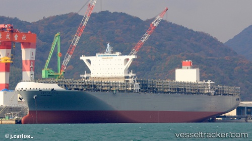
 Madrid Bridge
Current Status
Where is the vessel?
Madrid Bridge is currently in Near Little Creek, based on AIS data received about 1h ago.
Latest AIS update:
Current position: 36.98433° N, 76.15118° W (Near Little Creek)
Average speed (last 7 days): Loading…
Average speed (last 30 days): Loading…
Vessel profile: Madrid Bridge is a Container Ship with dimensions 366m x 51m.
This page combines live AIS, route history, probable destination signals, nearby traffic, and port activity for practical vessel monitoring.
The current position of vessel Madrid Bridge is 36.98433 lat / -76.15118 lng. Updated: 2026-05-14 11:23:39 UTCNearest reference points:
- Near Little Creek
- Near Sewell's Point
- Near Hampton Roads Pt
Currently sailing under the flag of Japan ![]()
Details:
Live Vessel Madrid Bridge Analytics (details, animations, etc.)
Recent AIS points (UTC):
2026-05-14 07:59:01 UTC · 36.91368, -76.32788 · SOG 0.1 kn · COG 353°2026-05-14 10:22:58 UTC · 36.94350, -76.33694 · SOG 8.2 kn · COG 4°
2026-05-14 10:32:28 UTC · 36.96560, -76.33503 · SOG 8.6 kn · COG 12°
2026-05-14 11:23:39 UTC · 36.98433, -76.15118 · SOG 11.4 kn · COG 106°