 vesseltracker.com
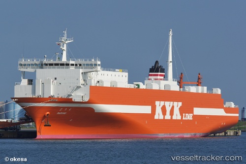
Marimo
Current StatusWhere is the vessel?
Marimo is currently in Near HITACHINAKA, based on AIS data received less than 1h ago.
Latest AIS update:
Current position: 36.43115° N, 140.61421° E (Near HITACHINAKA)
Average speed (last 7 days): Loading…
Average speed (last 30 days): Loading…
Vessel profile: Marimo is a Ro Ro Cargo Ship with dimensions 27m x 180m.
This page combines live AIS, route history, probable destination signals, nearby traffic, and port activity for practical vessel monitoring.
The current position of vessel Marimo is 36.43115 lat / 140.61421 lng. Updated: 2026-05-02 12:22:20 UTCNearest reference points:
- Near Mito
- Near KASHIMA
- 12 nm E of CHOSHI
Details:
Live Vessel Marimo Analytics (details, animations, etc.)
Recent AIS points (UTC):
2026-05-02 08:01:19 UTC · 36.43119, 140.61424 · SOG 0 kn · COG 270°2026-05-02 10:04:19 UTC · 36.43114, 140.61423 · SOG 0 kn · COG 270°
2026-05-02 10:07:19 UTC · 36.43115, 140.61420 · SOG 0 kn · COG 270°
2026-05-02 12:22:20 UTC · 36.43115, 140.61421 · SOG 0 kn · COG 270°