 vesseltracker.com
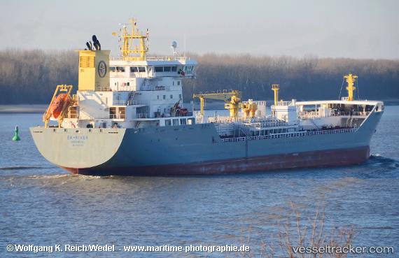
 Ek river
Current Status
Where is the vessel?
Ek river is currently in Near Landskrona, based on AIS data received about 1h ago.
Latest AIS update:
Current position: 55.85632° N, 12.83141° E (Near Landskrona)
Average speed (last 7 days): Loading…
Average speed (last 30 days): Loading…
Vessel profile: Ek river is a Chemical Tanker with dimensions 154m x 24m.
This page combines live AIS, route history, probable destination signals, nearby traffic, and port activity for practical vessel monitoring.
The current position of vessel Ek river is 55.85632 lat / 12.83141 lng. Updated: 2026-04-28 08:19:00 UTCNearest reference points:
- Near Landskrona
- Near Land Skrona
- Near Sankt Ibb
Currently sailing under the flag of Norway ![]()
Details:
Live Vessel Ek river Analytics (details, animations, etc.)
Recent AIS points (UTC):
2026-04-28 04:48:59 UTC · 55.85633, 12.83137 · SOG 0 kn · COG 131°2026-04-28 06:06:59 UTC · 55.85633, 12.83140 · SOG 0 kn · COG 131°
2026-04-28 08:07:00 UTC · 55.85632, 12.83141 · SOG 0 kn · COG 131°
2026-04-28 08:19:00 UTC · 55.85632, 12.83141 · SOG 0 kn · COG 131°