 vesseltracker.com
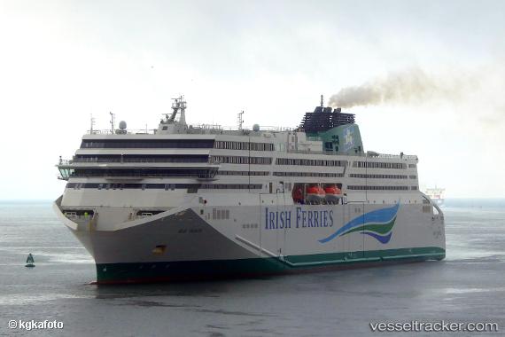
 W.b. Yeats
Current Status
Where is the vessel?
W.b. Yeats is currently in Near Cornwall, based on AIS data received about 1h ago.
Latest AIS update:
Current position: 49.93224° N, 4.21875° W (Near Cornwall)
Average speed (last 7 days): Loading…
Average speed (last 30 days): Loading…
Vessel profile: W.b. Yeats is a Passenger Ro Ro Cargo Ship with dimensions 194m x 30m.
This page combines live AIS, route history, probable destination signals, nearby traffic, and port activity for practical vessel monitoring.
The current position of vessel W.b. Yeats is 49.93224 lat / -4.21875 lng. Updated: 2026-05-15 21:25:27 UTCNearest reference points:
- 12 nm S of Cornwall
- 23 nm SW of Cornwall
- Near Plymouth
Currently sailing under the flag of Cyprus ![]()
Details:
Live Vessel W.b. Yeats Analytics (details, animations, etc.)
Recent AIS points (UTC):
2026-05-15 17:35:45 UTC · 50.06153, -2.51790 · SOG 16 kn · COG 271°2026-05-15 19:29:11 UTC · 49.97968, -3.30797 · SOG 17.1 kn · COG 266°
2026-05-15 20:00:27 UTC · 49.96703, -3.54317 · SOG 18 kn · COG 266°
2026-05-15 21:25:27 UTC · 49.93224, -4.21875 · SOG 18.9 kn · COG 270°