 vesseltracker.com
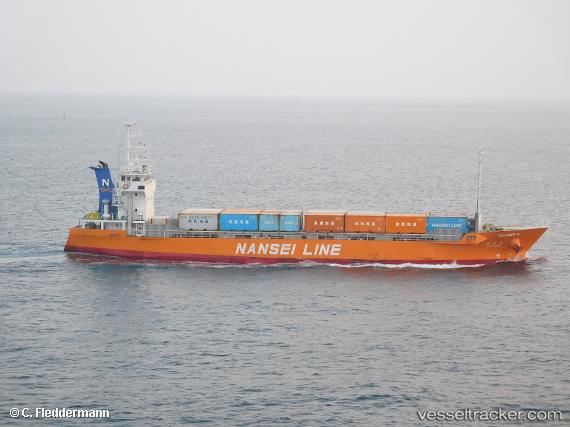
Chiyomaru
Current StatusWhere is the vessel?
Chiyomaru is currently in 31 nm SW of NISHINOOMOTE, based on AIS data received less than 1h ago.
Latest AIS update:
Current position: 30.27667° N, 130.69167° E (31 nm SW of NISHINOOMOTE)
Average speed (last 7 days): Loading…
Average speed (last 30 days): Loading…
Vessel profile: Chiyomaru is a General Cargo Ship with dimensions 13m x 75m.
This page combines live AIS, route history, probable destination signals, nearby traffic, and port activity for practical vessel monitoring.
The current position of vessel Chiyomaru is 30.27667 lat / 130.69167 lng. Updated: 2026-05-14 22:22:10 UTCNearest reference points:
- Near YAMAGAWA
- Near Kiire
- Near Kagoshima
Details:
Live Vessel Chiyomaru Analytics (details, animations, etc.)
Recent AIS points (UTC):
2026-05-14 19:29:19 UTC · 30.87895, 130.99361 · SOG 13.6 kn · COG 218°2026-05-14 19:55:42 UTC · 30.78807, 130.94897 · SOG 13.5 kn · COG 199°
2026-05-14 21:22:10 UTC · 30.48833, 130.80333 · SOG 13 kn · COG -1°
2026-05-14 22:22:10 UTC · 30.27667, 130.69167 · SOG 13 kn · COG -1°