 vesseltracker.com
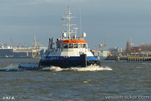
 Ella F
Current Status
Where is the vessel?
Ella F is currently in Near Sekupang, based on AIS data received less than 1h ago.
Latest AIS update:
Current position: 1.05136° N, 103.90768° E (Near Sekupang)
Average speed (last 7 days): Loading…
Average speed (last 30 days): Loading…
Vessel profile: Ella F is a Tug with dimensions 36m x 36m.
This page combines live AIS, route history, probable destination signals, nearby traffic, and port activity for practical vessel monitoring.
The current position of vessel Ella F is 1.05136 lat / 103.90768 lng. Updated: 2026-04-30 17:33:11 UTCNearest reference points:
- Near Sekupang
- Near Batam Island
- Near Sambu
Currently sailing under the flag of Netherlands ![]()
Details:
Live Vessel Ella F Analytics (details, animations, etc.)
Recent AIS points (UTC):
2026-04-30 13:54:05 UTC · 1.05131, 103.90767 · SOG 0 kn · COG 339°2026-04-30 15:45:06 UTC · 1.05131, 103.90765 · SOG 0 kn · COG 340°
2026-04-30 16:12:05 UTC · 1.05132, 103.90767 · SOG 0 kn · COG 340°
2026-04-30 17:33:11 UTC · 1.05136, 103.90768 · SOG 0 kn · COG 347°