 vesseltracker.com
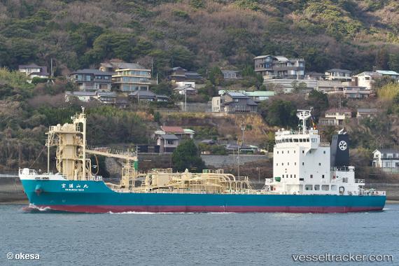
 Houmanzan Maru
Current Status
Where is the vessel?
Houmanzan Maru is currently in Near KANDA, based on AIS data received less than 1h ago.
Latest AIS update:
Current position: 33.80117° N, 131.04272° E (Near KANDA)
Average speed (last 7 days): Loading…
Average speed (last 30 days): Loading…
Vessel profile: Houmanzan Maru is a Cement Carrier with dimensions 84m x 14m.
This page combines live AIS, route history, probable destination signals, nearby traffic, and port activity for practical vessel monitoring.
The current position of vessel Houmanzan Maru is 33.80117 lat / 131.04272 lng. Updated: 2026-05-15 10:23:19 UTCNearest reference points:
- Near KANDA
- Near Kanmon
- Near Shimonoseki
Currently sailing under the flag of Japan ![]()
Details:
Live Vessel Houmanzan Maru Analytics (details, animations, etc.)
Recent AIS points (UTC):
2026-05-15 07:05:21 UTC · 33.80109, 131.04288 · SOG 0 kn · COG 75°2026-05-15 07:47:18 UTC · 33.80123, 131.04285 · SOG 0 kn · COG 88°
2026-05-15 09:53:19 UTC · 33.80114, 131.04279 · SOG 0 kn · COG 77°
2026-05-15 10:23:19 UTC · 33.80117, 131.04272 · SOG 0.1 kn · COG 78°