 vesseltracker.com
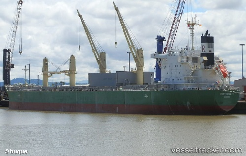
 VICTORIA T
Current Status
Where is the vessel?
VICTORIA T is currently in Near Houston, based on AIS data received about 1h ago.
Latest AIS update:
Current position: 29.74091° N, 95.28215° W (Near Houston)
Average speed (last 7 days): Loading…
Average speed (last 30 days): Loading…
Vessel profile: VICTORIA T is a Cargo with dimensions m x m.
This page combines live AIS, route history, probable destination signals, nearby traffic, and port activity for practical vessel monitoring.
The current position of vessel VICTORIA T is 29.74091 lat / -95.28215 lng. Updated: 2026-05-14 20:08:49 UTCNearest reference points:
- Near Pasadena
- Near Jacinto City
- Near Morgan Point
Currently sailing under the flag of Liberia ![]()
Details:
Live Vessel VICTORIA T Analytics (details, animations, etc.)
Recent AIS points (UTC):
2026-05-14 16:11:51 UTC · 29.74089, -95.28215 · SOG 0 kn · COG 145°2026-05-14 17:33:00 UTC · 29.74094, -95.28220 · SOG 0.1 kn · COG 145°
2026-05-14 19:05:49 UTC · 29.74093, -95.28216 · SOG 0 kn · COG 145°
2026-05-14 20:08:49 UTC · 29.74091, -95.28215 · SOG 0.1 kn · COG 145°