 vesseltracker.com
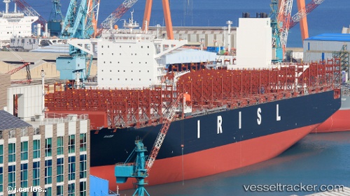
 RADIN
RADIN
Current Status
Where is the vessel?
RADIN is currently in 10 nm S of Pulau Indah, based on AIS data received less than 1h ago.
Latest AIS update:
Current position: 2.76584° N, 101.31378° E (10 nm S of Pulau Indah)
Average speed (last 7 days): Loading…
Average speed (last 30 days): Loading…
Vessel profile: RADIN is a Container Ship with dimensions 48m x 366m.
This page combines live AIS, route history, probable destination signals, nearby traffic, and port activity for practical vessel monitoring.
The current position of vessel RADIN is 2.76584 lat / 101.31378 lng. Updated: 2026-05-14 18:14:46 UTCNearest reference points:
- Near Carey Island Estate
- Near Pulau Indah
- Near Banting
Currently sailing under the flag of Iran ![]()
RADIN built in 2018 year
Deadweight:
148611 tDetails:
Live Vessel RADIN Analytics (details, animations, etc.)
Recent AIS points (UTC):
2026-05-14 14:23:49 UTC · 2.76626, 101.31140 · SOG 0 kn · COG 146°2026-05-14 15:35:45 UTC · 2.76610, 101.31120 · SOG 0 kn · COG 146°
2026-05-14 16:56:44 UTC · 2.76631, 101.31143 · SOG 0 kn · COG 162°
2026-05-14 18:14:46 UTC · 2.76584, 101.31378 · SOG 0.2 kn · COG 236°