 vesseltracker.com
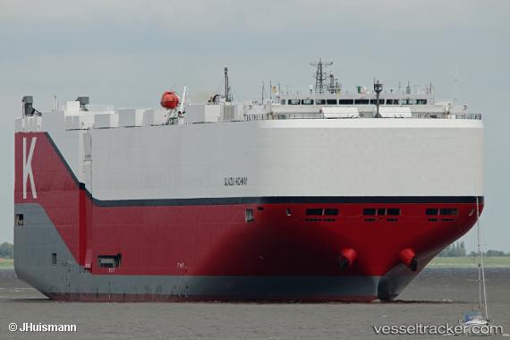
 Iguazu Highway
Current Status
Where is the vessel?
Iguazu Highway is currently in 10 nm W of Strait Of Gibraltar, based on AIS data received about 1h ago.
Latest AIS update:
Current position: 35.95723° N, 5.95684° W (10 nm W of Strait Of Gibraltar)
Average speed (last 7 days): Loading…
Average speed (last 30 days): Loading…
Vessel profile: Iguazu Highway is a Vehicles Carrier with dimensions 199m x 37m.
This page combines live AIS, route history, probable destination signals, nearby traffic, and port activity for practical vessel monitoring.
The current position of vessel Iguazu Highway is 35.95723 lat / -5.95684 lng. Updated: 2026-05-14 07:22:55 UTCNearest reference points:
- Near TARIFA
- Near Conil de la Frontera
- Near Gibraltar
Currently sailing under the flag of Panama ![]()
Details:
Live Vessel Iguazu Highway Analytics (details, animations, etc.)
Recent AIS points (UTC):
2026-05-14 04:14:07 UTC · 36.05134, -5.16288 · SOG 13.4 kn · COG 257°2026-05-14 06:19:25 UTC · 35.94861, -5.67173 · SOG 12.6 kn · COG 267°
2026-05-14 07:03:35 UTC · 35.95918, -5.87331 · SOG 12.7 kn · COG 265°
2026-05-14 07:22:55 UTC · 35.95723, -5.95684 · SOG 12.5 kn · COG 270°