 vesseltracker.com
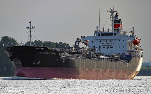
 Chemstar Tierra
Current Status
Where is the vessel?
Chemstar Tierra is currently in Near Courtenay Bay, based on AIS data received less than 1h ago.
Latest AIS update:
Current position: 45.27505° N, 66.03997° W (Near Courtenay Bay)
Average speed (last 7 days): Loading…
Average speed (last 30 days): Loading…
Vessel profile: Chemstar Tierra is a Chemical Oil Products Tanker with dimensions 149m x 24m.
This page combines live AIS, route history, probable destination signals, nearby traffic, and port activity for practical vessel monitoring.
The current position of vessel Chemstar Tierra is 45.27505 lat / -66.03997 lng. Updated: 2026-05-14 19:11:35 UTCNearest reference points:
- Near St. John
- Near Tiverton
- 16 nm W of Tiverton
Currently sailing under the flag of Panama ![]()
Details:
Live Vessel Chemstar Tierra Analytics (details, animations, etc.)
Recent AIS points (UTC):
2026-05-14 15:38:35 UTC · 45.27505, -66.03998 · SOG 0 kn · COG 345°2026-05-14 16:14:35 UTC · 45.27503, -66.03999 · SOG 0.1 kn · COG 345°
2026-05-14 17:29:35 UTC · 45.27505, -66.03999 · SOG 0 kn · COG 345°
2026-05-14 19:11:35 UTC · 45.27505, -66.03997 · SOG 0 kn · COG 346°