 vesseltracker.com
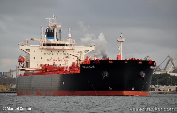
Ionian Star
Current StatusWhere is the vessel?
Ionian Star is currently in 12 nm N of Khambhaliya, based on AIS data received less than 1h ago.
Latest AIS update:
Current position: 22.54735° N, 69.60568° E (12 nm N of Khambhaliya)
Average speed (last 7 days): Loading…
Average speed (last 30 days): Loading…
Vessel profile: Ionian Star is a Oil Products Tanker with dimensions 32m x 183m.
This page combines live AIS, route history, probable destination signals, nearby traffic, and port activity for practical vessel monitoring.
The current position of vessel Ionian Star is 22.54735 lat / 69.60568 lng. Updated: 2026-05-16 04:22:38 UTCNearest reference points:
- Near SIKKA
- Near Khambhaliya
- Near Sika
Details:
Live Vessel Ionian Star Analytics (details, animations, etc.)
Recent AIS points (UTC):
2026-05-16 01:40:38 UTC · 22.54845, 69.60417 · SOG 0.2 kn · COG 186°2026-05-16 02:19:38 UTC · 22.54734, 69.60553 · SOG 0.1 kn · COG 274°
2026-05-16 03:40:38 UTC · 22.54718, 69.60561 · SOG 0.1 kn · COG 269°
2026-05-16 04:22:38 UTC · 22.54735, 69.60568 · SOG 0.3 kn · COG 280°