 vesseltracker.com
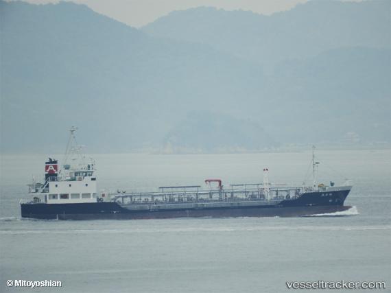
 Turuhiromaru
Current Status
Where is the vessel?
Turuhiromaru is currently in Near Kawasaki, based on AIS data received about 1h ago.
Latest AIS update:
Current position: 35.50791° N, 139.83449° E (Near Kawasaki)
Average speed (last 7 days): Loading…
Average speed (last 30 days): Loading…
Vessel profile: Turuhiromaru is a Oil Products Tanker with dimensions 73m x 12m.
This page combines live AIS, route history, probable destination signals, nearby traffic, and port activity for practical vessel monitoring.
The current position of vessel Turuhiromaru is 35.50791 lat / 139.83449 lng. Updated: 2026-04-29 18:12:54 UTCNearest reference points:
- Near Aomi
- Near Kawasaki
- Near Yokohama
Currently sailing under the flag of Japan ![]()
Details:
Live Vessel Turuhiromaru Analytics (details, animations, etc.)
Recent AIS points (UTC):
2026-04-29 13:36:52 UTC · 35.50777, 139.83459 · SOG 0 kn · COG 66°2026-04-29 16:18:53 UTC · 35.50794, 139.83450 · SOG 0.1 kn · COG 79°
2026-04-29 16:33:53 UTC · 35.50792, 139.83452 · SOG 0 kn · COG 75°
2026-04-29 18:12:54 UTC · 35.50791, 139.83449 · SOG 0 kn · COG 71°