 vesseltracker.com
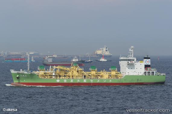
 Taikimaru
Current Status
Where is the vessel?
Taikimaru is currently in 25 nm SE of Minachi, based on AIS data received about 1h ago.
Latest AIS update:
Current position: 33.54852° N, 136.12073° E (25 nm SE of Minachi)
Average speed (last 7 days): Loading…
Average speed (last 30 days): Loading…
Vessel profile: Taikimaru is a Cement Carrier with dimensions 96m x 18m.
This page combines live AIS, route history, probable destination signals, nearby traffic, and port activity for practical vessel monitoring.
The current position of vessel Taikimaru is 33.54852 lat / 136.12073 lng. Updated: 2026-04-26 23:52:17 UTCNearest reference points:
- 23 nm S of Minachi
- 18 nm SE of Gobo Wakayama
- 20 nm S of HAMAJIMA
Currently sailing under the flag of Japan ![]()
Details:
Live Vessel Taikimaru Analytics (details, animations, etc.)
Recent AIS points (UTC):
2026-04-26 18:35:51 UTC · 34.18364, 137.19678 · SOG 11.9 kn · COG 235°2026-04-26 21:52:55 UTC · 33.79510, 136.54451 · SOG 12.6 kn · COG 238°
2026-04-26 22:14:20 UTC · 33.75151, 136.46848 · SOG 13 kn · COG 238°
2026-04-26 23:52:17 UTC · 33.54852, 136.12073 · SOG 12.8 kn · COG 235°