 vesseltracker.com
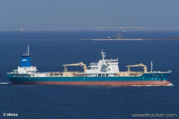
 Takaoki Maru
Current Status
Where is the vessel?
Takaoki Maru is currently in Near TOBA, based on AIS data received less than 1h ago.
Latest AIS update:
Current position: 34.59667° N, 136.81667° E (Near TOBA)
Average speed (last 7 days): Loading…
Average speed (last 30 days): Loading…
Vessel profile: Takaoki Maru is a Cement Carrier with dimensions 158m x 24m.
This page combines live AIS, route history, probable destination signals, nearby traffic, and port activity for practical vessel monitoring.
The current position of vessel Takaoki Maru is 34.59667 lat / 136.81667 lng. Updated: 2026-05-01 19:59:24 UTCNearest reference points:
- Near TOBA
- Near Atumi
- Near Mihama
Currently sailing under the flag of Japan ![]()
Details:
Live Vessel Takaoki Maru Analytics (details, animations, etc.)
Recent AIS points (UTC):
2026-05-01 16:29:22 UTC · 34.59667, 136.81500 · SOG 0 kn · COG -1°2026-05-01 17:23:20 UTC · 34.59667, 136.81500 · SOG 0 kn · COG -1°
2026-05-01 19:32:21 UTC · 34.59667, 136.81500 · SOG 0 kn · COG -1°
2026-05-01 19:59:24 UTC · 34.59667, 136.81667 · SOG 0 kn · COG -1°