 vesseltracker.com
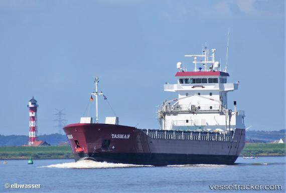
 TASMAN
Current Status
Where is the vessel?
TASMAN is currently in Near Georgetown, based on AIS data received about 1h ago.
Latest AIS update:
Current position: 6.79500° N, 58.17167° W (Near Georgetown)
Average speed (last 7 days): Loading…
Average speed (last 30 days): Loading…
Vessel profile: TASMAN is a Cargo with dimensions m x m.
This page combines live AIS, route history, probable destination signals, nearby traffic, and port activity for practical vessel monitoring.
The current position of vessel TASMAN is 6.79500 lat / -58.17167 lng. Updated: 2026-05-13 22:41:48 UTCNearest reference points:
- 57 nm NE of Adventure
- 38 nm NW of Jarikaba
Currently sailing under the flag of Netherlands ![]()
Details:
Live Vessel TASMAN Analytics (details, animations, etc.)
Recent AIS points (UTC):
2026-05-13 19:32:20 UTC · 6.79500, -58.17167 · SOG 0 kn · COG -1°2026-05-13 19:50:22 UTC · 6.79500, -58.17167 · SOG 0 kn · COG -1°
2026-05-13 21:47:40 UTC · 6.79500, -58.17167 · SOG 0 kn · COG -1°
2026-05-13 22:41:48 UTC · 6.79500, -58.17167 · SOG 0 kn · COG -1°