 vesseltracker.com
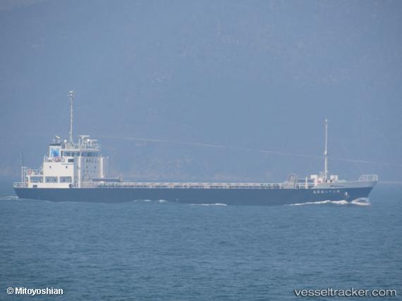
 Dai38shinkoumaru
Current Status
Where is the vessel?
Dai38shinkoumaru is currently in Near Ube, based on AIS data received less than 1h ago.
Latest AIS update:
Current position: 33.89977° N, 131.11794° E (Near Ube)
Average speed (last 7 days): Loading…
Average speed (last 30 days): Loading…
Vessel profile: Dai38shinkoumaru is a General Cargo Ship with dimensions 74m x 12m.
This page combines live AIS, route history, probable destination signals, nearby traffic, and port activity for practical vessel monitoring.
The current position of vessel Dai38shinkoumaru is 33.89977 lat / 131.11794 lng. Updated: 2026-05-15 07:49:11 UTCNearest reference points:
- Near Ube
- Near KANDA
- Near Shimonoseki
Currently sailing under the flag of Japan ![]()
Details:
Live Vessel Dai38shinkoumaru Analytics (details, animations, etc.)
Recent AIS points (UTC):
2026-05-14 23:13:35 UTC · 33.87500, 130.80396 · SOG 0 kn · COG -1°2026-05-14 23:13:35 UTC · 33.87500, 130.80396 · SOG 0 kn · COG -1°
2026-05-15 07:07:07 UTC · 33.96983, 130.98042 · SOG 13 kn · COG 68°
2026-05-15 07:49:11 UTC · 33.89977, 131.11794 · SOG 12 kn · COG 123°