 vesseltracker.com
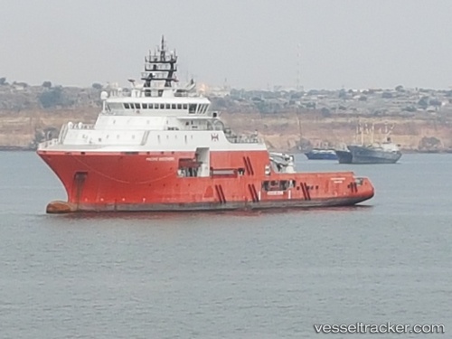
 PACIFIC DISCOVERY
Current Status
Where is the vessel?
PACIFIC DISCOVERY is currently in 13 nm NE of Monopoli, based on AIS data received less than 1h ago.
Latest AIS update:
Current position: 41.28367° N, 17.50610° E (13 nm NE of Monopoli)
Average speed (last 7 days): Loading…
Average speed (last 30 days): Loading…
Vessel profile: PACIFIC DISCOVERY is a Anchor Handling Vessel with dimensions m x m.
This page combines live AIS, route history, probable destination signals, nearby traffic, and port activity for practical vessel monitoring.
The current position of vessel PACIFIC DISCOVERY is 41.28367 lat / 17.50610 lng. Updated: 2026-05-02 07:15:27 UTCNearest reference points:
- Near Monopoli
- Near Porto Di Brindisi
- Near Marina di Ginosa
Currently sailing under the flag of United Kingdom ![]()
Details:
Live Vessel PACIFIC DISCOVERY Analytics (details, animations, etc.)
Recent AIS points (UTC):
2026-05-02 04:11:57 UTC · 40.95745, 17.92619 · SOG 8.9 kn · COG 316°2026-05-02 05:00:36 UTC · 41.04468, 17.81598 · SOG 8.6 kn · COG 316°
2026-05-02 06:18:25 UTC · 41.18213, 17.63990 · SOG 9 kn · COG 314°
2026-05-02 07:15:27 UTC · 41.28367, 17.50610 · SOG 8.8 kn · COG 315°