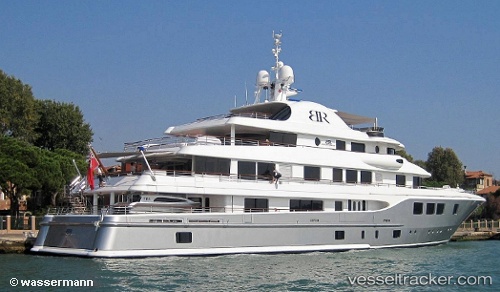
 Baton Rouge
Current Status
Where is the vessel?
Baton Rouge is currently in Near LA CIOTAT, based on AIS data received about 257d ago.
Latest AIS update:
Current position: 43.17049° N, 5.61330° E (Near LA CIOTAT)
Average speed (last 7 days): Loading…
Average speed (last 30 days): Loading…
Vessel profile: Baton Rouge is a Service Ship with dimensions 63m x 12m.
This page combines live AIS, route history, probable destination signals, nearby traffic, and port activity for practical vessel monitoring.
The current position of vessel Baton Rouge is 43.17049 lat / 5.61330 lng. Updated: 2025-09-03 17:21:28 UTCNearest reference points:
- Near LA CIOTAT
- Near Six-Fours-les-Plages
- Near Le Canet
Currently sailing under the flag of United Kingdom ![]()
Baton Rouge built in 2010 year
Details:
Live Vessel Baton Rouge Analytics (details, animations, etc.)
Recent AIS points (UTC):
2025-09-03 17:21:28 UTC · 43.17049, 5.61330 · SOG 0 kn · COG 221°