 Chacabuco
Current Status
Where is the vessel?
Chacabuco is currently in 32 nm W of Haring, based on AIS data received about 14h ago.
Latest AIS update:
Current position: 41.29662° N, 11.43420° E (32 nm W of Haring)
Average speed (last 7 days): Loading…
Average speed (last 30 days): Loading…
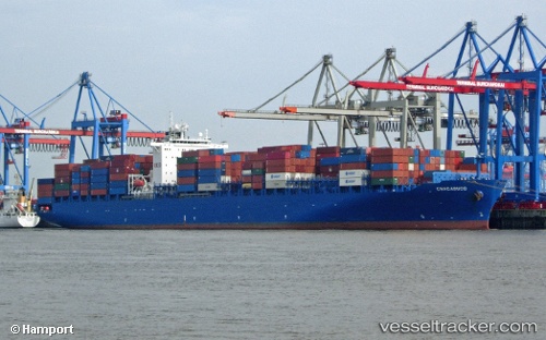
Vessel profile: Chacabuco is a Container Ship with dimensions 275m x 275m.
This page combines live AIS, route history, probable destination signals, nearby traffic, and port activity for practical vessel monitoring.
The current position of vessel Chacabuco is 41.29662 lat / 11.43420 lng. Updated: 2026-05-22 16:43:57 UTCNearest reference points:
- Near Fiumicino
- Near Santa Marinella
- Near Civitavecchia
Currently sailing under the flag of Liberia ![]()
Chacabuco built in 2006 year
Deadweight:
68228 tDetails:
Live Vessel Chacabuco Analytics (details, animations, etc.)
Recent AIS points (UTC):
2026-05-22 13:06:11 UTC · 41.85503, 10.61562 · SOG 13.2 kn · COG 135°2026-05-22 13:28:31 UTC · 41.79842, 10.69563 · SOG 13.3 kn · COG 133°
2026-05-22 15:45:20 UTC · 41.44783, 11.21431 · SOG 14 kn · COG 132°
2026-05-22 16:43:57 UTC · 41.29662, 11.43420 · SOG 13.6 kn · COG 128°