.

Port East Hazel Crest

Where is the Port?
EAST HAZEL CREST is located near the monitored sea lanes. The official UN/LOCODE of this port is USEHC.

How many vessels are in East Hazel Crest port?
There are currently 27 vessels in port and 2 vessels recently departed.

Port map updates in near real-time from AIS snapshots and route transitions. Use the vessel-type filters and names toggle in the map control.

CA flag Algoterra

Vessel type: Chemical Oil Products Tanker | IMO: 9442249 | MMSI: MMSI: 316015050
Call sign: VCZR | Dimensions: 144 m x 23 m
Current Status

Where is the vessel?

Algoterra is currently in Near Burnham, based on AIS data received about 15h ago.

Latest AIS update:

Current position: 41.66641° N, 87.58328° W (Near Burnham)

Average speed (last 7 days): Loading…

Average speed (last 30 days): Loading…

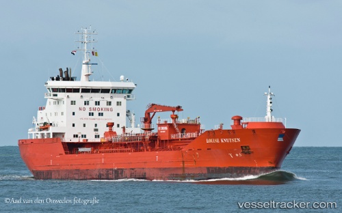
Vessel profile: Algoterra is a Chemical Oil Products Tanker with dimensions 144m x 23m.

This page combines live AIS, route history, probable destination signals, nearby traffic, and port activity for practical vessel monitoring.

The current position of vessel Algoterra is 41.66641 lat / -87.58328 lng. Updated: 2026-05-22 10:16:06 UTC
More recent position available: 23 min ago
Free positions are delayed by 14 hours.

We recommend registering. If you register, paid vessel access will be saved in your profile. Guest access works only through a personal link.

Nearest reference points:
  • Near Burnham
  • Near Burns Harbor
  • Near WAUKEGAN

Currently sailing under the flag of Canada CA flag

Algoterra built in 2010 year

Deadweight:
16512 t

Details:

Live Vessel Algoterra Analytics (details, animations, etc.)


Recent AIS points (UTC):
2026-05-22 07:25:07 UTC · 41.66643, -87.58326 · SOG 0 kn · COG 142°
2026-05-22 07:48:59 UTC · 41.66645, -87.58328 · SOG 0 kn · COG 142°
2026-05-22 09:58:04 UTC · 41.66644, -87.58327 · SOG 0 kn · COG 141°
2026-05-22 10:16:06 UTC · 41.66641, -87.58328 · SOG 0 kn · COG 141°

Track of the vessel in the last 60 days


Most frequent incoming origins

No route destination distribution yet.

Most frequent outgoing destinations

No route destination distribution yet.


You can see routes between ports on port-to-port analytics.


Link to the map:


Find another ship

Recent vessel arrivals at the port

Latest available transitions/port-call records (UTC). Total: 2
2025-09-15 12:59 UTC · 'GWYNETH ANNE'
IMO: 0, MMSI: 367794470 | Type:
2025-09-08 16:20 UTC · 'GWYNETH ANNE'
IMO: 0, MMSI: 367794470 | Type:

Recent vessel departures from the port

Latest available transitions/port-call records (UTC). Total: 2
2025-09-15 12:59 UTC · 'GWYNETH ANNE'
IMO: 0, MMSI: 367794470 | Type:
2025-09-08 16:20 UTC · 'GWYNETH ANNE'
IMO: 0, MMSI: 367794470 | Type:

Shipping companies (lines) whose ships most often called at the port East Hazel Crest:

No companies linked yet.

Port summary

Port congestion score

Loading congestion data…

Vessel type distribution for the last 3 months:

Unknown · 7 calls (87.5%)
Chemical Oil Products Tanker · 1 calls (12.5%)

Most frequent incoming origins

No route destination distribution yet.

Most frequent outgoing destinations

No route destination distribution yet.

Vessels currently in port

Detected by latest AIS in the extended port area, latest 72 hours (deduplicated by vessel).

BULL SHIP
Type: Unknown | IMO: 0, MMSI: 338226203 | AIS: 2026-05-23 00:50:55 UTC
POCO LOCO
Type: Unknown | IMO: 0, MMSI: 338352822 | AIS: 2026-05-22 21:05:06 UTC
993660667
Type: Unknown | IMO: 0, MMSI: 993660667 | AIS: 2026-05-22 21:00:14 UTC
CA flagRobert-S.-Pierson
Type: Self Discharging Bulk Carrier | IMO: 7366403, MMSI: 316011905 | AIS: 2026-05-22 20:17:10 UTC
US flagOLIVE L. MOORE
Type: Unknown | IMO: 8635227, MMSI: 367480250 | AIS: 2026-05-22 20:17:10 UTC
TANNER
Type: Unknown | IMO: 0, MMSI: 367325490 | AIS: 2026-05-22 20:17:09 UTC
US flagLB2
Type: Unknown | IMO: 0, MMSI: 993672228 | AIS: 2026-05-22 20:17:08 UTC
US flagJOE DERBAS
Type: Spare - Local Vessel | IMO: 0, MMSI: 368437390 | AIS: 2026-05-22 20:17:04 UTC
US flagBURNS HARBOR
Type: Self Discharging Bulk Carrier | IMO: 7514713, MMSI: 367050160 | AIS: 2026-05-22 20:17:04 UTC
'CODY BOYD'
Type: Unknown | IMO: 0, MMSI: 367702080 | AIS: 2026-05-22 20:17:03 UTC
US flagMEREDITH ASHTON
Type: Tug | IMO: 8964460, MMSI: 366988420 | AIS: 2026-05-22 20:17:02 UTC
Rebeccalynn
Type: Tug | IMO: 6511374, MMSI: 366936810 | AIS: 2026-05-22 20:17:00 UTC
CA flagAlgoterra
Type: Chemical Oil Products Tanker | IMO: 9442249, MMSI: 316015050 | AIS: 2026-05-22 20:16:06 UTC
Lee-A-Tregurtha
Type: Self Discharging Bulk Carrier | IMO: 5385625, MMSI: 366904950 | AIS: 2026-05-22 20:15:32 UTC
US flagINDIANA
Type: Tug | IMO: 1316834, MMSI: 368283540 | AIS: 2026-05-22 20:15:15 UTC
'DELBERT E KNOY'
Type: Unknown | IMO: 0, MMSI: 368009880 | AIS: 2026-05-22 20:15:11 UTC
US flagILLINOIS
Type: Tug | IMO: 1316833, MMSI: 368228180 | AIS: 2026-05-22 20:15:00 UTC
US flagLEE W
Type: Unknown | IMO: 1297828, MMSI: 368113360 | AIS: 2026-05-22 20:14:42 UTC
NL flagFraserborg
Type: General Cargo Ship | IMO: 9419319, MMSI: 245639000 | AIS: 2026-05-22 20:14:04 UTC
MAID MARION
Type: Unknown | IMO: 0, MMSI: 338355342 | AIS: 2026-05-22 20:12:30 UTC
368131310
Type: Unknown | IMO: 1300900, MMSI: 368131310 | AIS: 2026-05-22 20:12:23 UTC
MISS ALLIE
Type: Unknown | IMO: 0, MMSI: 367528420 | AIS: 2026-05-22 20:11:46 UTC
US flagBILLIE RUTH
Type: Unknown | IMO: 1300846, MMSI: 368131290 | AIS: 2026-05-22 20:07:33 UTC
338027666
Type: Unknown | IMO: 0, MMSI: 338027666 | AIS: 2026-05-22 19:57:23 UTC
NATHAN S
Type: Unknown | IMO: 8841967, MMSI: 367787430 | AIS: 2026-05-21 20:14:10 UTC
338200003
Type: Unknown | IMO: 0, MMSI: 338200003 | AIS: 2026-05-21 19:57:53 UTC
MORGAN
Type: Unknown | IMO: 0, MMSI: 367325460 | AIS: 2026-05-21 12:45:03 UTC

Expected arrivals

Forecast from transitions and inferred destination signals.


Port in news

Mentions from Topos news feed and spotlights.