 NORMA JEAN
Current Status
Where is the vessel?
NORMA JEAN is currently in 28 nm SE of Sneads Ferry, based on AIS data received about 15h ago.
Latest AIS update:
Current position: 34.17333° N, 77.03667° W (28 nm SE of Sneads Ferry)
Average speed (last 7 days): Loading…
Average speed (last 30 days): Loading…
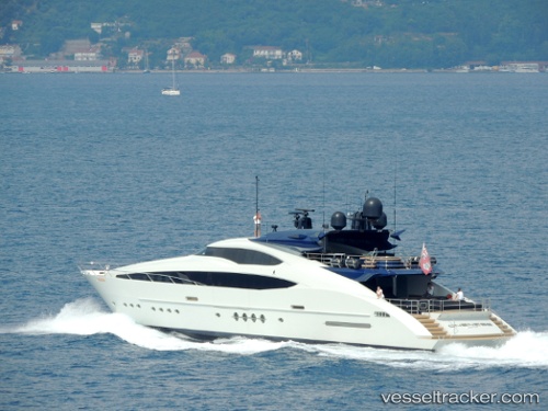
Vessel profile: NORMA JEAN is a Yacht with dimensions m x m.
This page combines live AIS, route history, probable destination signals, nearby traffic, and port activity for practical vessel monitoring.
The current position of vessel NORMA JEAN is 34.17333 lat / -77.03667 lng. Updated: 2026-05-21 16:19:29 UTCNearest reference points:
- Near Morehead City
- Near BEAUFORT
- 11 nm N of BEAUFORT
Currently sailing under the flag of Cayman Islands ![]()
Details:
Live Vessel NORMA JEAN Analytics (details, animations, etc.)
Recent AIS points (UTC):
2026-05-21 13:19:27 UTC · 33.64500, -77.46500 · SOG 12 kn · COG -1°2026-05-21 13:52:28 UTC · 33.74167, -77.38833 · SOG 12 kn · COG -1°
2026-05-21 16:16:28 UTC · 34.16500, -77.04333 · SOG 12 kn · COG -1°
2026-05-21 16:19:29 UTC · 34.17333, -77.03667 · SOG 12 kn · COG -1°