


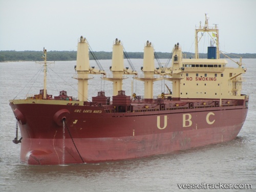
 Ubc Santa Marta
Current Status
Where is the vessel?
Ubc Santa Marta is currently in 210 nm SE of Bald Rock, based on AIS data received about 14h ago.
Latest AIS update:
Current position: 41.32618° N, 61.44774° W (210 nm SE of Bald Rock)
Average speed (last 7 days): Loading…
Average speed (last 30 days): Loading…
Vessel profile: Ubc Santa Marta is a Bulk Carrier with dimensions 171m x 27m.
This page combines live AIS, route history, probable destination signals, nearby traffic, and port activity for practical vessel monitoring.
The current position of vessel Ubc Santa Marta is 41.32618 lat / -61.44774 lng. Updated: 2026-05-26 13:43:33 UTCNearest reference points:
- 116 nm SE of Sheet Harbour
- 260 nm W of Jonesville
Currently sailing under the flag of Cyprus 
Details:
Live Vessel Ubc Santa Marta Analytics (details, animations, etc.)
Recent AIS points (UTC):
2026-05-26 09:42:27 UTC · 40.84844, -62.05878 · SOG 10.1 kn · COG 35°2026-05-26 11:37:54 UTC · 41.08072, -61.77740 · SOG 10.5 kn · COG 40°
2026-05-26 13:14:23 UTC · 41.26928, -61.52081 · SOG 9.7 kn · COG 43°
2026-05-26 13:43:33 UTC · 41.32618, -61.44774 · SOG 9.7 kn · COG 46°