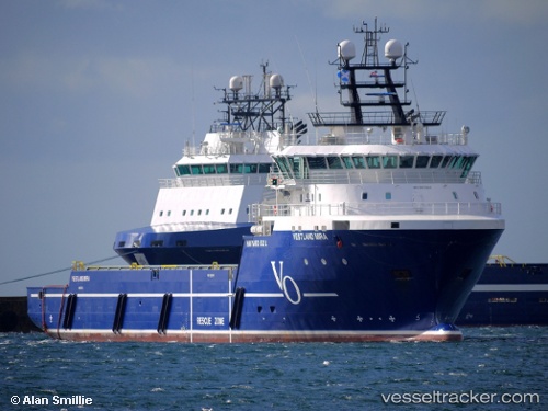
 REM MIRA
Current Status
Where is the vessel?
REM MIRA is currently in 15 nm W of Etrick Field, based on AIS data received about 14h ago.
Latest AIS update:
Current position: 57.99198° N, 1.02737° W (15 nm W of Etrick Field)
Average speed (last 7 days): Loading…
Average speed (last 30 days): Loading…
Vessel profile: REM MIRA is a Offshore Supply Ship with dimensions m x m.
This page combines live AIS, route history, probable destination signals, nearby traffic, and port activity for practical vessel monitoring.
The current position of vessel REM MIRA is 57.99198 lat / -1.02737 lng. Updated: 2026-05-18 22:27:39 UTCNearest reference points:
- Near Peterhead
- Near PETERHEAD
- Near Aberdeen
Currently sailing under the flag of Cyprus ![]()
Details:
Live Vessel REM MIRA Analytics (details, animations, etc.)
Recent AIS points (UTC):
2026-05-18 19:30:59 UTC · 58.16842, -0.78431 · SOG 3.7 kn · COG 200°2026-05-18 19:55:52 UTC · 58.14333, -0.81167 · SOG 4 kn · COG -1°
2026-05-18 21:19:53 UTC · 58.05833, -0.93167 · SOG 4 kn · COG -1°
2026-05-18 22:27:39 UTC · 57.99198, -1.02737 · SOG 4.3 kn · COG 208°