 KORONI
Current Status
Where is the vessel?
KORONI is currently in 46 nm NE of Kualalangsa, based on AIS data received about 14h ago.
Latest AIS update:
Current position: 4.88061° N, 98.70268° E (46 nm NE of Kualalangsa)
Average speed (last 7 days): Loading…
Average speed (last 30 days): Loading…
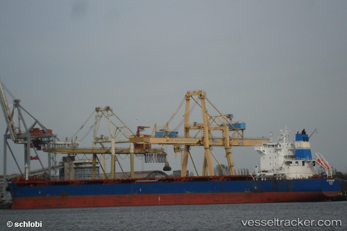
Vessel profile: KORONI is a Bulk Carrier with dimensions m x m.
This page combines live AIS, route history, probable destination signals, nearby traffic, and port activity for practical vessel monitoring.
The current position of vessel KORONI is 4.88061 lat / 98.70268 lng. Updated: 2026-05-20 22:43:58 UTCNearest reference points:
- 43 nm NE of PANGKALAN SUSU
- 18 nm E of Langsa Venture FPSO
- Near Belawan
Currently sailing under the flag of Cyprus ![]()
Details:
Live Vessel KORONI Analytics (details, animations, etc.)
Recent AIS points (UTC):
2026-05-20 19:08:49 UTC · 4.50941, 99.15770 · SOG 10.2 kn · COG 307°2026-05-20 19:22:59 UTC · 4.53362, 99.12611 · SOG 10 kn · COG 307°
2026-05-20 22:19:38 UTC · 4.83084, 98.74778 · SOG 9.9 kn · COG 319°
2026-05-20 22:43:58 UTC · 4.88061, 98.70268 · SOG 10.1 kn · COG 313°