 JULIETTA D
Current Status
Where is the vessel?
JULIETTA D is currently in 17 nm SW of Banting, based on AIS data received about 15h ago.
Latest AIS update:
Current position: 2.65873° N, 101.25400° E (17 nm SW of Banting)
Average speed (last 7 days): Loading…
Average speed (last 30 days): Loading…
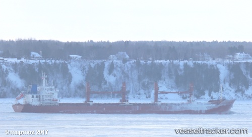
Vessel profile: JULIETTA D is a Cargo with dimensions 190m x 28m.
This page combines live AIS, route history, probable destination signals, nearby traffic, and port activity for practical vessel monitoring.
The current position of vessel JULIETTA D is 2.65873 lat / 101.254 lng. Updated: 2026-05-21 00:00:45 UTCNearest reference points:
- 15 nm SW of Banting
- 14 nm SW of Banting
- Near Pulau Indah
Currently sailing under the flag of Malta ![]()
JULIETTA D built in 2013 year
Deadweight:
37202 tDetails:
Live Vessel JULIETTA D Analytics (details, animations, etc.)
Recent AIS points (UTC):
2026-05-20 12:19:35 UTC · 4.23938, 99.65900 · SOG 11.3 kn · COG -1°2026-05-20 22:04:17 UTC · 2.84507, 100.91700 · SOG 12 kn · COG 115°
2026-05-20 22:18:56 UTC · 2.81949, 100.95900 · SOG 11.9 kn · COG 114°
2026-05-21 00:00:45 UTC · 2.65873, 101.25400 · SOG 11.8 kn · COG 114°