 TORM HANNAH
Current Status
Where is the vessel?
TORM HANNAH is currently in 26 nm SW of Bunga Raya, based on AIS data received about 15h ago.
Latest AIS update:
Current position: 6.74673° N, 103.72307° E (26 nm SW of Bunga Raya)
Average speed (last 7 days): Loading…
Average speed (last 30 days): Loading…
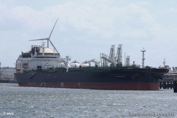
Vessel profile: TORM HANNAH is a Crude Oil Tanker with dimensions 249m x 44m.
This page combines live AIS, route history, probable destination signals, nearby traffic, and port activity for practical vessel monitoring.
The current position of vessel TORM HANNAH is 6.74673 lat / 103.72307 lng. Updated: 2026-05-20 01:53:19 UTCNearest reference points:
- 23 nm E of Muda Marine Terminal
- Near Muda Marine Terminal
- 46 nm N of Penara Marine Terminal
Currently sailing under the flag of Denmark (DIS) ![]()
TORM HANNAH built in 2016 year
Deadweight:
109999 tDetails:
Live Vessel TORM HANNAH Analytics (details, animations, etc.)
Recent AIS points (UTC):
2026-05-19 23:02:52 UTC · 7.20524, 103.35344 · SOG 12.9 kn · COG -1°2026-05-20 00:06:02 UTC · 7.01674, 103.46873 · SOG 12.4 kn · COG -1°
2026-05-20 01:53:19 UTC · 6.74673, 103.72307 · SOG 12.2 kn · COG -1°
2026-05-20 01:53:19 UTC · 6.74673, 103.72307 · SOG 12.2 kn · COG -1°