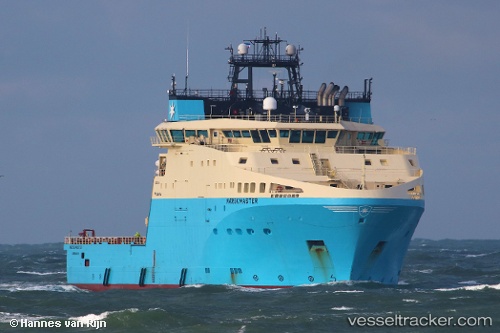
 Maersk Master
Current Status
Where is the vessel?
Maersk Master is currently in Near Montrose, based on AIS data received about 14h ago.
Latest AIS update:
Current position: 56.70340° N, 2.47072° W (Near Montrose)
Average speed (last 7 days): Loading…
Average speed (last 30 days): Loading…
Vessel profile: Maersk Master is a Offshore Tug Supply Ship with dimensions 95m x 25m.
This page combines live AIS, route history, probable destination signals, nearby traffic, and port activity for practical vessel monitoring.
The current position of vessel Maersk Master is 56.70340 lat / -2.47072 lng. Updated: 2026-05-23 01:37:53 UTCNearest reference points:
- Near BROUGHTY FERRY
- Near Aberdeen
- Near North Berwick
Currently sailing under the flag of Denmark ![]()
Details:
Live Vessel Maersk Master Analytics (details, animations, etc.)
Recent AIS points (UTC):
2026-05-22 22:32:59 UTC · 56.70338, -2.47073 · SOG 0 kn · COG 129°2026-05-22 23:47:58 UTC · 56.70341, -2.47071 · SOG 0 kn · COG 129°
2026-05-23 01:32:58 UTC · 56.70340, -2.47072 · SOG 0 kn · COG 129°
2026-05-23 01:37:53 UTC · 56.70340, -2.47072 · SOG 0 kn · COG 129°