 Normandie
Current Status
Where is the vessel?
Normandie is currently in 32 nm SE of Cadaqués, based on AIS data received about 14h ago.
Latest AIS update:
Current position: 42.07190° N, 3.93878° E (32 nm SE of Cadaqués)
Average speed (last 7 days): Loading…
Average speed (last 30 days): Loading…
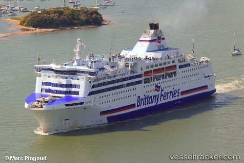
Vessel profile: Normandie is a Passenger Ro Ro Cargo Ship with dimensions 161m x 26m.
This page combines live AIS, route history, probable destination signals, nearby traffic, and port activity for practical vessel monitoring.
The current position of vessel Normandie is 42.07190 lat / 3.93878 lng. Updated: 2026-05-22 05:55:43 UTCNearest reference points:
- 13 nm E of L'ESTARTIT
- Near L'ESTARTIT
- Near Port Vendres
Currently sailing under the flag of France ![]()
Normandie built in 1992 year
Deadweight:
5229 tDetails:
Live Vessel Normandie Analytics (details, animations, etc.)
Recent AIS points (UTC):
2026-05-22 02:09:04 UTC · 41.20039, 3.03335 · SOG 17.2 kn · COG 37°2026-05-22 04:05:05 UTC · 41.64824, 3.48836 · SOG 17.3 kn · COG 46°
2026-05-22 04:22:02 UTC · 41.69977, 3.57416 · SOG 17.6 kn · COG 51°
2026-05-22 05:55:43 UTC · 42.07190, 3.93878 · SOG 17.7 kn · COG 37°