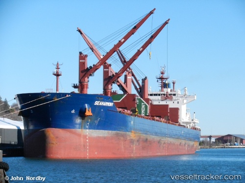
 SEAHARMONY
Current Status
Where is the vessel?
SEAHARMONY is currently in 289 nm SW of Sao Filipe, based on AIS data received about 14h ago.
Latest AIS update:
Current position: 11.29500° N, 27.79833° W (289 nm SW of Sao Filipe)
Average speed (last 7 days): Loading…
Average speed (last 30 days): Loading…
Vessel profile: SEAHARMONY is a Bulk Carrier with dimensions 199m x 32m.
This page combines live AIS, route history, probable destination signals, nearby traffic, and port activity for practical vessel monitoring.
The current position of vessel SEAHARMONY is 11.29500 lat / -27.79833 lng. Updated: 2026-05-21 22:10:57 UTCNearest reference points:
- Open sea, approx. 400 nm off the nearest listed port
- Open sea, approx. 401 nm off the nearest listed port
- Open sea, approx. 404 nm off the nearest listed port
Currently sailing under the flag of Malta ![]()
SEAHARMONY built in 2015 year
Deadweight:
62770 tDetails:
Live Vessel SEAHARMONY Analytics (details, animations, etc.)
Recent AIS points (UTC):
2026-05-21 17:40:55 UTC · 12.12667, -27.52667 · SOG 11 kn · COG -1°2026-05-21 19:10:56 UTC · 11.85333, -27.61833 · SOG 11 kn · COG -1°
2026-05-21 19:51:09 UTC · 11.73062, -27.65408 · SOG 11.5 kn · COG 193°
2026-05-21 22:10:57 UTC · 11.29500, -27.79833 · SOG 11 kn · COG -1°