 Haaga
Haaga
Current Status
Where is the vessel?
Haaga is currently in Near Hammerhavn, based on AIS data received about 14h ago.
Latest AIS update:
Current position: 55.38707° N, 14.65717° E (Near Hammerhavn)
Average speed (last 7 days): Loading…
Average speed (last 30 days): Loading…
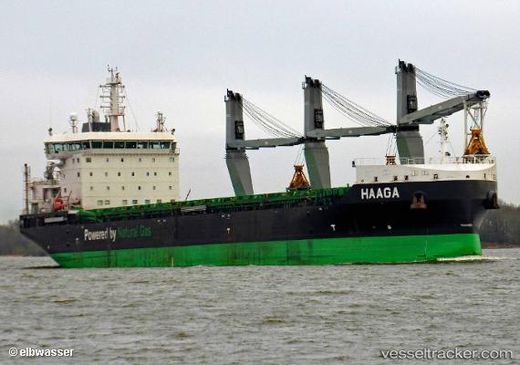
Vessel profile: Haaga is a Bulk Carrier with dimensions 160m x 26m.
This page combines live AIS, route history, probable destination signals, nearby traffic, and port activity for practical vessel monitoring.
The current position of vessel Haaga is 55.38707 lat / 14.65717 lng. Updated: 2026-05-21 22:09:13 UTCNearest reference points:
- Near TEJN
- Near Åhus
- Near Sölvesborg
Currently sailing under the flag of Finland ![]()
Details:
Live Vessel Haaga Analytics (details, animations, etc.)
Recent AIS points (UTC):
2026-05-21 19:54:15 UTC · 55.06166, 14.18202 · SOG 11.7 kn · COG 39°2026-05-21 20:11:55 UTC · 55.10655, 14.24379 · SOG 11.5 kn · COG 38°
2026-05-21 21:53:55 UTC · 55.35239, 14.60164 · SOG 11 kn · COG 38°
2026-05-21 22:09:13 UTC · 55.38707, 14.65717 · SOG 11.2 kn · COG 62°