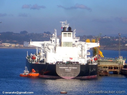
 Paramount Hatteras
Current Status
Where is the vessel?
Paramount Hatteras is currently in Near Map Ta Phut, based on AIS data received about 14h ago.
Latest AIS update:
Current position: 12.58474° N, 101.19907° E (Near Map Ta Phut)
Average speed (last 7 days): Loading…
Average speed (last 30 days): Loading…
Vessel profile: Paramount Hatteras is a Crude Oil Tanker with dimensions 250m x 44m.
This page combines live AIS, route history, probable destination signals, nearby traffic, and port activity for practical vessel monitoring.
The current position of vessel Paramount Hatteras is 12.58474 lat / 101.19907 lng. Updated: 2026-05-22 08:29:55 UTCNearest reference points:
- 11 nm S of Map Ta Phut
- Near SATTAHIP
- 33 nm S of SATTAHIP
Currently sailing under the flag of United Kingdom ![]()
Paramount Hatteras built in 2010 year
Deadweight:
114700 tDetails:
Live Vessel Paramount Hatteras Analytics (details, animations, etc.)
Recent AIS points (UTC):
2026-05-22 04:17:47 UTC · 12.58310, 101.20117 · SOG 0 kn · COG 249°2026-05-22 05:35:47 UTC · 12.58335, 101.20120 · SOG 0 kn · COG 244°
2026-05-22 07:41:47 UTC · 12.58473, 101.19964 · SOG 0 kn · COG 186°
2026-05-22 08:29:55 UTC · 12.58474, 101.19907 · SOG 0 kn · COG 168°