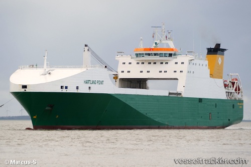
 Hartland Point
Current Status
Where is the vessel?
Hartland Point is currently in 52 nm NE of Ryuo, based on AIS data received about 14h ago.
Latest AIS update:
Current position: 36.33333° N, 17.28833° E (52 nm NE of Ryuo)
Average speed (last 7 days): Loading…
Average speed (last 30 days): Loading…
Vessel profile: Hartland Point is a Ro Ro Cargo Ship with dimensions 193m x 193m.
This page combines live AIS, route history, probable destination signals, nearby traffic, and port activity for practical vessel monitoring.
The current position of vessel Hartland Point is 36.33333 lat / 17.28833 lng. Updated: 2026-05-19 13:10:18 UTCNearest reference points:
- 53 nm NE of Ryuo
- 64 nm NE of Ryuo
- 33 nm N of Ryuo
Currently sailing under the flag of United Kingdom ![]()
Hartland Point built in 2002 year
Deadweight:
13274 tDetails:
Live Vessel Hartland Point Analytics (details, animations, etc.)
Recent AIS points (UTC):
2026-05-19 10:23:03 UTC · 36.42903, 16.32738 · SOG 16.5 kn · COG 96°2026-05-19 11:58:18 UTC · 36.36833, 16.87333 · SOG 16 kn · COG -1°
2026-05-19 13:10:18 UTC · 36.33333, 17.28833 · SOG 16 kn · COG -1°
2026-05-19 13:10:18 UTC · 36.33333, 17.28833 · SOG 16 kn · COG -1°