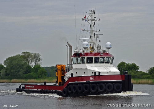
 ELISA
ELISA
Current Status
Where is the vessel?
ELISA is currently in 20 nm NW of Blokhus, based on AIS data received about 14h ago.
Latest AIS update:
Current position: 57.40215° N, 9.04470° E (20 nm NW of Blokhus)
Average speed (last 7 days): Loading…
Average speed (last 30 days): Loading…
Vessel profile: ELISA is a Tug with dimensions m x m.
This page combines live AIS, route history, probable destination signals, nearby traffic, and port activity for practical vessel monitoring.
The current position of vessel ELISA is 57.40215 lat / 9.04470 lng. Updated: 2026-05-22 16:38:10 UTCNearest reference points:
- 27 nm N of HANSTHOLM
- 28 nm NW of Lokken
- Near HANSTHOLM
Currently sailing under the flag of Gibraltar ![]()
Details:
Live Vessel ELISA Analytics (details, animations, etc.)
Recent AIS points (UTC):
2026-05-22 13:07:51 UTC · 57.27649, 8.71535 · SOG 3.5 kn · COG 52°2026-05-22 13:30:19 UTC · 57.29010, 8.74767 · SOG 3.6 kn · COG 52°
2026-05-22 15:45:49 UTC · 57.37141, 8.96618 · SOG 3.6 kn · COG 52°
2026-05-22 16:38:10 UTC · 57.40215, 9.04470 · SOG 3.8 kn · COG 57°