 vesseltracker.com
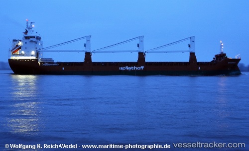
 Maasgracht
Current Status
Where is the vessel?
Maasgracht is currently in 12 nm S of Cape Leeuwin, based on AIS data received about 14h ago.
Latest AIS update:
Current position: 34.72458° S, 115.10926° E (12 nm S of Cape Leeuwin)
Average speed (last 7 days): Loading…
Average speed (last 30 days): Loading…
Vessel profile: Maasgracht is a General Cargo Ship with dimensions 142m x 19m.
This page combines live AIS, route history, probable destination signals, nearby traffic, and port activity for practical vessel monitoring.
The current position of vessel Maasgracht is -34.72458 lat / 115.10926 lng. Updated: 2026-05-18 01:48:09 UTCNearest reference points:
- Near Bunbury
- Near Kwinana
Currently sailing under the flag of Netherlands ![]()
Maasgracht built in 2011 year
Deadweight:
11759 tDetails:
Live Vessel Maasgracht Analytics (details, animations, etc.)
Recent AIS points (UTC):
2026-05-17 22:10:23 UTC · -34.24681, 114.65427 · SOG 10.5 kn · COG 168°2026-05-18 00:03:46 UTC · -34.54541, 114.79119 · SOG 11.3 kn · COG 121°
2026-05-18 01:34:16 UTC · -34.70061, 115.06768 · SOG 10.7 kn · COG 125°
2026-05-18 01:48:09 UTC · -34.72458, 115.10926 · SOG 11 kn · COG 125°