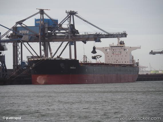
Omaha
Current StatusWhere is the vessel?
Omaha is currently in Near Waterport, based on AIS data received about 14h ago.
Latest AIS update:
Current position: 36.05291° N, 5.19153° W (Near Waterport)
Average speed (last 7 days): Loading…
Average speed (last 30 days): Loading…
Vessel profile: Omaha is a Bulk Carrier with dimensions 45m x 292m.
This page combines live AIS, route history, probable destination signals, nearby traffic, and port activity for practical vessel monitoring.
The current position of vessel Omaha is 36.05291 lat / -5.19153 lng. Updated: 2026-05-22 22:14:31 UTCNearest reference points:
- Near Waterport
- Near La Línea de la Concepción
- Near Algeciras
Details:
Live Vessel Omaha Analytics (details, animations, etc.)
Recent AIS points (UTC):
2026-05-22 17:50:50 UTC · 36.22635, -4.08975 · SOG 11.8 kn · COG 258°2026-05-22 19:07:31 UTC · 36.16160, -4.40207 · SOG 12.5 kn · COG 261°
2026-05-22 20:22:50 UTC · 36.11780, -4.72027 · SOG 12.4 kn · COG 258°
2026-05-22 22:14:31 UTC · 36.05291, -5.19153 · SOG 12.2 kn · COG 261°