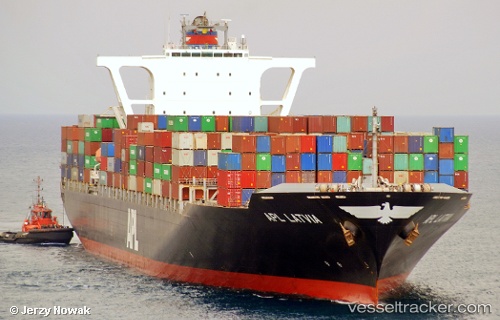
 ANL GIPPSLAND
Current Status
Where is the vessel?
ANL GIPPSLAND is currently in 199 nm S of Deboyne Lagoon, based on AIS data received about 14h ago.
Latest AIS update:
Current position: 14.09179° S, 152.58987° E (199 nm S of Deboyne Lagoon)
Average speed (last 7 days): Loading…
Average speed (last 30 days): Loading…
Vessel profile: ANL GIPPSLAND is a Container Ship with dimensions m x m.
This page combines live AIS, route history, probable destination signals, nearby traffic, and port activity for practical vessel monitoring.
The current position of vessel ANL GIPPSLAND is -14.09179 lat / 152.58987 lng. Updated: 2026-05-23 01:51:07 UTCNearest reference points:
- 209 nm N of Coral Sea
Currently sailing under the flag of Malta ![]()
Details:
Live Vessel ANL GIPPSLAND Analytics (details, animations, etc.)
Recent AIS points (UTC):
2026-05-22 22:52:37 UTC · -15.02327, 152.76129 · SOG 18.8 kn · COG 352°2026-05-22 23:38:39 UTC · -14.78340, 152.72240 · SOG 18.7 kn · COG -1°
2026-05-23 01:43:58 UTC · -14.12933, 152.59657 · SOG 19 kn · COG 353°
2026-05-23 01:51:07 UTC · -14.09179, 152.58987 · SOG 18.8 kn · COG 353°