 Chodziez
Current Status
Where is the vessel?
Chodziez is currently in 47 nm E of Kualalangsa, based on AIS data received about 15h ago.
Latest AIS update:
Current position: 4.82723° N, 98.73660° E (47 nm E of Kualalangsa)
Average speed (last 7 days): Loading…
Average speed (last 30 days): Loading…
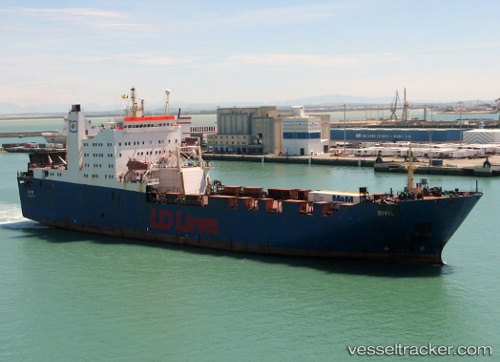
Vessel profile: Chodziez is a Ro Ro Cargo Ship with dimensions 148m x 24m.
This page combines live AIS, route history, probable destination signals, nearby traffic, and port activity for practical vessel monitoring.
The current position of vessel Chodziez is 4.82723 lat / 98.73660 lng. Updated: 2026-05-22 07:23:31 UTCNearest reference points:
- 43 nm NE of PANGKALAN SUSU
- 18 nm E of Langsa Venture FPSO
- Near Belawan
Currently sailing under the flag of Malta ![]()
Chodziez built in 1988 year
Deadweight:
8044 tDetails:
Live Vessel Chodziez Analytics (details, animations, etc.)
Recent AIS points (UTC):
2026-05-22 04:48:42 UTC · 5.15677, 98.36585 · SOG 11.6 kn · COG -1°2026-05-22 05:33:36 UTC · 5.05937, 98.46659 · SOG 11.3 kn · COG -1°
2026-05-22 05:33:36 UTC · 5.05937, 98.46659 · SOG 11.3 kn · COG -1°
2026-05-22 07:23:31 UTC · 4.82723, 98.73660 · SOG 11.8 kn · COG 131°